

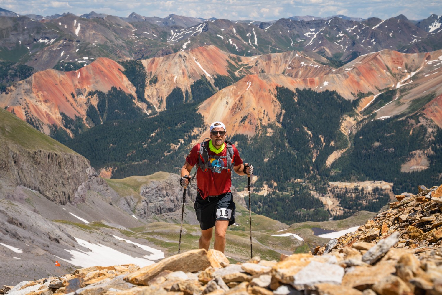
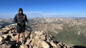
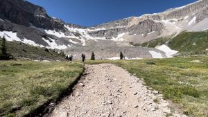
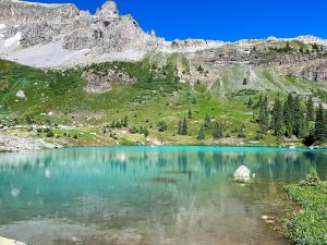
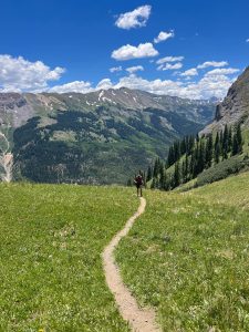
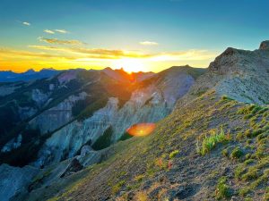
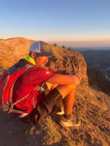
Photo from mile 19, making the push up the long climb to Fort Peabody, the high point of the Ouray 100 course at 13,340 feet. Photo credit Eszter Horanyi.
The Ouray 100 Endurance Run had long been a dream of mine, since about 8 years ago when I first started looking at doing a 100 mile running event. Back then I remember seeing an article for the Ouray 100 in Trail Runner Magazine and thinking this run must be the toughest hundred-miler out there, and while I was far from ready to do something like that at the time, someday I would be able to make an attempt at it. Pretty much every year since then I’ve been motivated by signing up for and training for a tough 100 mile run, each year upping the difficulty. But it wasn’t until this year when my friend Jeff suggested I finally do Ouray, and that he thought I was ready, that I dared sign up.
Signing up for this event scared me which ensured my training was solid and that I was fit for the event. Several months of 3-5 hour sessions running 100 foot hill repeats, as well as strength training, on top of my normal running load, built my legs up to handle the time on feet and ascending/descending. This was the idea, and I would soon find out if it was indeed enough. A 67 mile long run a month before Ouray at the Dawn to Dusk Endurance Run near home, in which I felt good the whole time and recovered very well, had me feeling like my training was really coming to plan. So I was confident that at least I had done everything I could do to be ready.
My Dad and I flew out from Wisconsin to Colorado on Monday morning before the run which started Friday morning. We drove from the Mile High City of Denver right to Leadville, the Two Mile High City to start acclimating at 10,152 feet. My Garmin watch told me throughout the week that I was acclimating about 10-15% each day, so I know this really helped get me ready for Friday.

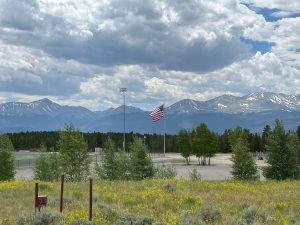
View from Leadville of Mount Elbert (left) Mount Massive (right) looming overhead.
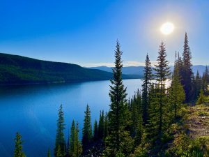
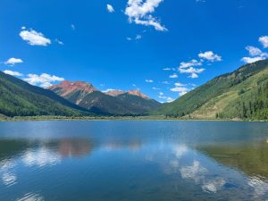
Turquoise Lake
After getting settled into our VRBO on Monday my Dad and I wanted to get a couple hikes in on Tuesday and Wednesday before heading to Ouray on Thursday. So on Tuesday morning we drove around the very stunning Turquoise Lake to the Timberline Lake Trailhead to explore that area. Both the drive there and the hike itself were really nice. It was a good and easy start to the week. Then in the afternoon we rented eBikes and rode the Mineral Belt Trail around Leadville which was a great way to see the whole Leadville area.
Timberline Lake
Mount Elbert
On Wednesday we hiked Mount Elbert which is Colorado’s highest peak. Going into this I knew it was going to be a big test of how ready I was for the Ouray 100 in a couple days – both validating my hill & strength training the months before, as well as how my acclimating to elevation was going. While not at all easy, I felt good during and after; so I considered it a good result for my readiness for the big task at hand starting Friday.
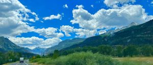
The drive into Ouray
On Thursday we drove to Ouray and my friend Nic joined the team. He and my Dad would crew me during the event with Nic jumping in as pacer starting the morning of Day 2 at mile 53. A really hard mountain 100 miler like this is truly a team event, there is no way I could accomplish such a feat without them. My estimate of when Nic would start pacing me was based on my pace plan that I had put together. The event gives you 52 hours to finish and I figured it best to be conservative and assume it would take me all of that long to finish.
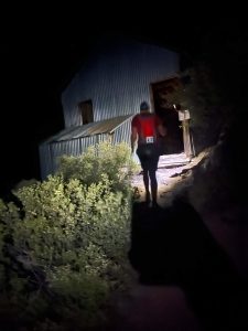
It’s gonna be a long couple of days.
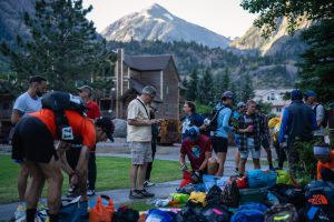
Friday morning at the start line of the Ouray 100 Endurance Run. Photo credit Eszter Horanyi.
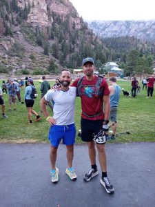
Nic is ready to join me! But he’ll have a wait about 24 hours.
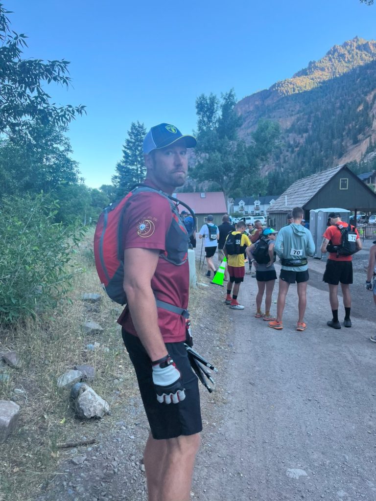
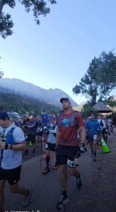
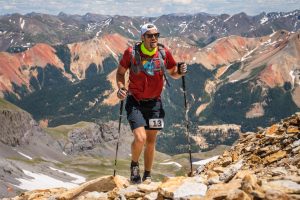
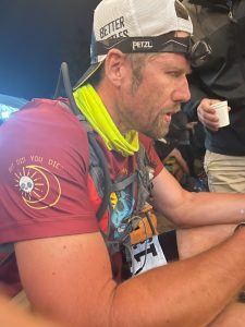
After years of thinking about this event and months of training I was excited to finally be on the start line, despite the trepidation you could see written across my face.
Mile 0
Making the climb up to Silver Basin Lake
Silver Basin Lake
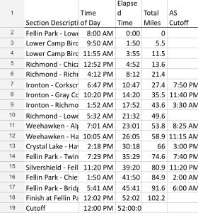
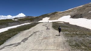
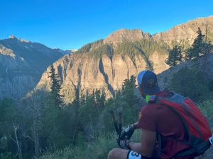
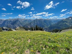
The Run started in the town of Ouray, CO elevation 7,792 feet, and had 13 big climbs. First up was Silver Basin Lake at mile 9 and elevation of 11,644 feet. Knowing I had a long couple of days ahead of me I just tried to enjoy the views and not overthink anything. This first climb wasn’t too bad, mostly jeep roads and never too steep.
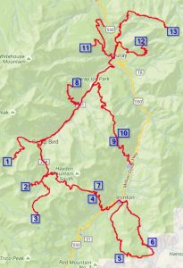
The 13 Climbs of the Ouray 100 Endurance Run
- Silver Basin Lake (mile 9 – 11,644 feet)
- Chicago Tunnel Mine (mile 15 – 12,241 feet)
- Fort Peabody (mile 19 – 13,340 feet)
- Richmond Pass (mile 24 – 12,657 feet)
- Corkscrew Gulch (mile 31 – 12,247 feet)
- Gray Copper Gulch (mile 40 – 11,328 feet)
- Richmond Pass again (mile 47 – 12,657 feet)
- Alpine Mine Overlook (mile 56 – 10,968 feet)
- Hayden Pass (mile 64 – 12,008 feet)
- Hayden Pass again (mile 68 – 12,008 feet)
- Twin Peaks (mile 80 – 10,764 feet)
- Chief Ouray Mine (mile 91 – 10,135 feet)
- Bridge of Heaven (mile 98 – 12,267 feet)
Getting steeper. Getting harder.
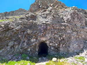
Chicago Tunnel
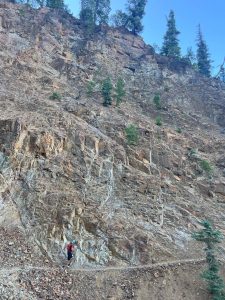
Next up at mile 15 was climb #2 to Chicago Tunnel Mine at 12,241 feet. The last mile was very steep and tough, the footing uncertain – having a dry dusty slickness in many spots. It was the type of climb I’ve only experienced in the mountains in which you see people way up ahead and way above, and they are so small and far away that you just try not to think too much about just how far you have to go. It was the first of many of this type of ascent.
Imogene Pass ![]()
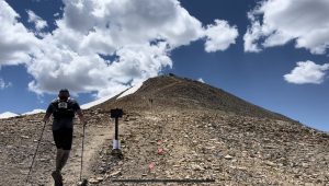
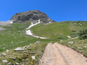
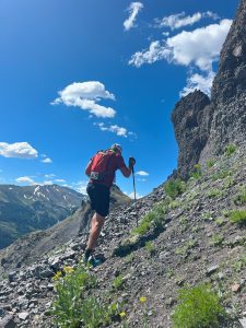
Leaving the jeep road for the climb over scree to the top.
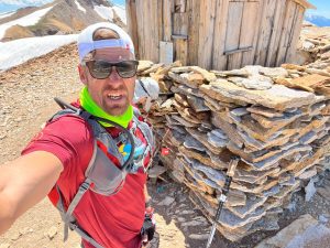
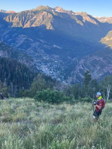
For Climb #3 at mile 19 we continued up Imogene Pass to Fort Peabody at 13,340 feet, this was the high point of the course. The “top of the world” view from here was definitely breathtaking.
Top of the Fort Peabody summit. Photo credit Eszter Horanyi.
Read more about Fort Peabody here: https://en.wikipedia.org/wiki/Fort_Peabody
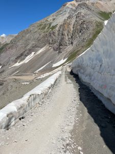
By this time running into a lot of snow on the trail.
Richmond Pass
At mile 24 was climb #4, Richmond pass, at 12,657 feet. Lots more snowfields up there. They had said it had been unusually bad winter and there would be a lot more snow than typical. The rope in the above photo was to ensure you didn’t slip and slide off. I held it tight! This was afternoon of Day 1, and the afternoon is when the possibility of a thunderstorms is most likely. I had been concerned about that, in the past at this event runners have had to wait out lightning storms for hours to go over a pass and this was very detrimental to their ability to finish. Thankfully there would be no bad storms to contend with this weekend, but there would be heat, especially coming up on Day 2.
Cooling off in one of the snowfields.
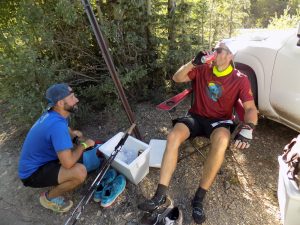
Ironton Aid Station, the first crew stop.
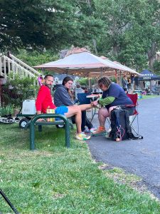
After the very steep descent off of Richmond Pass, climbs 5 & 6 were Corkscrew Gulch and Gray Copper Gulch topping out at 12,247 feet. Before these climbs at mile 27 I was able to meet up with my crew for the first time at the Ironton Aid Station. It was a really big boost to see my Dad and Nic after 10 hours of hard running and hiking.
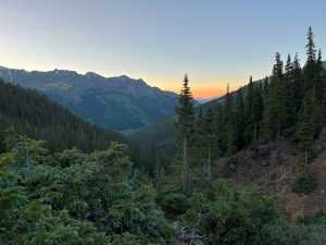
Sun setting over Gray Copper Gulch.
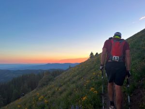
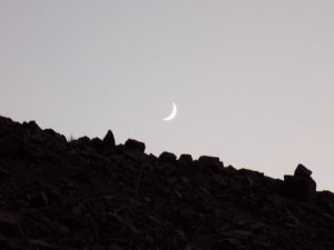 Around mile 35 started the first night.
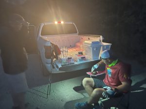
I would see my crew here at Ironton three times total before heading back over Richmond Pass.
Pretty sure in this photo I’m thinking about the climb back over Richmond Pass that I had ahead of me. I knew it would be much steeper going the opposite direction and that the snowfields would be much more treacherous in the cold and dark.
It was very, very tough but I made it back over Richmond Pass. The steep climbs were very slow. The snowfields were very slick. It was cold and windy. But it was just a few more miles until I would meet up with Nic which kept me moving well.
Alpine Mine Overlook
The next climb was #8, the Alpine Mine Overlook at 10,968 feet. At this point the sun was rising on Saturday morning, I was at around mile 53, and Nic had joined me to start pacing. Getting to this point where he could run with me was a huge boost. I knew I’d likely not have him for every single one of the 47 remaining miles, but I knew I could count on him for most of them. This first climb with Nic went well and he made sure I ate a good breakfast of scrambled eggs at the aid station when we got back to the bottom.
Hayden Pass. Photo credit Eszter Horanyi.
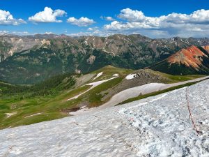
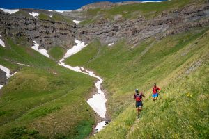
Next at mile 64 it was up to 12,008 feet over Hayden Pass to Crystal Lake, then back again over the pass a second time. This was the middle of the day Saturday and it was very hot and exposed. It was mid-90s at the lower elevations which got a little cooler up top, but the sun at 12k feet still feels pretty oppressive. But it was also some of the most beautiful views – so many wildflowers.
Crystal Lake
Hayden Pass views…
With the heat, by the time I got back to the aid station at Fellin Park in Ouray I was pretty overheated. Nic had to take a break for a few miles so he could rehydrate, he hadn’t carried enough water and hadn’t been able to drink nearly as much as he needed. Thankfully my Dad got me cooled down, and then fed, and after about 45 minutes I was moving again toward Twin Peaks.
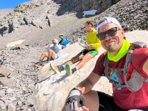
I was on my own for this section up to climb #11 Twin Peaks (mile 80) but I pushed hard to get it done quick so Nic could rejoin me. Without my pacer I did get lost for a bit but only for about 15 minutes. This getting lost bit did scare me though. After overheating and recovering from that, then getting lost and finding my way again, I knew I was at a critical point where the run could go either very good or very bad yet.
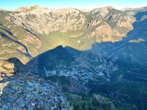
Twin Peaks had a really nice view of the town of Ouray down below.
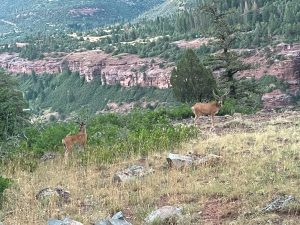
I saw a fair amount of wildlife including a porcupine with quills out scrambling in the scree above me to get away during the first night (this was before the hallucinations of night 2), and some deer, pictured here.
The very technical climb up to Twin Peaks (about 1800 feet in the last mile with some scrambling at the top) was done. Now only 2 climbs left and Nic was rejoining me for the final night. We were moving well, but plenty could go wrong yet.
Chief Ouray Mine
Climb #12 Chief Ouray Mine was at mile 91 and at 10,135 feet. It was spooky in the dark and an adventure to get to, with a water crossing only 20 feet away from a thundering waterfall that we could hear but not see. Then it was back down for the last crew stop for a quick eat and drink before the final push. I just had some soup and coke, I probably should have had more caffeine but didn’t want to push it and risk my stomach going south with only 10 miles left.
The climb up to Bridge of Heaven was literally one foot in front of the other. Step on that rock, then that rock, then the next rock…
Somehow the time during the slow final ascent went fast, probably due to my sleepiness. I kept forgetting where I was and Nic told me I was swaying back and forth a lot. I was regretting not drinking more caffeine. But I knew once the sun started to shine I would wake up. Every so often a runner would come back tearing down the mountain, and I’ve never been so jealous. But soon that would be me.
The Bridge of Heaven
Finally at mile 99 Nic and I topped out onto the Bridge of Heaven, just in time to see the sun rising. There were a few of us up there taking it all in. We probably could have spent an hour up there enjoying the moment, but Nic and I wanted to get this done.
Soaking it in. 5 miles back down the mountain and it’s over!
So back down down we went… (that’s Ouray down there, and the finish line).
And down…
The Ouray 100 Finish Line
Miles 99-104 back down the mountain into Ouray went so fast with only one stop to address a stick that Nic somehow got stuck in his chin. (First time I’ve ever seen that.)
The medical team at the finish area pulling out the rest of the stick still stuck in Nic’s shin.
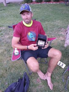
The buckle.
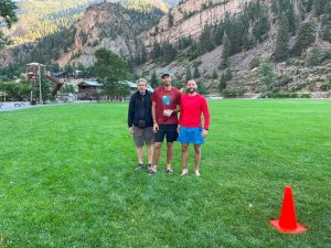
Huge thanks to Jeff who convinced me I could finish this run, to my Dad for his excellent crewing, to Nic for his inspiring pacing, and to my wife Kelly for managing everything back at home while I was away.
Strava link: https://www.strava.com/activities/9506767232